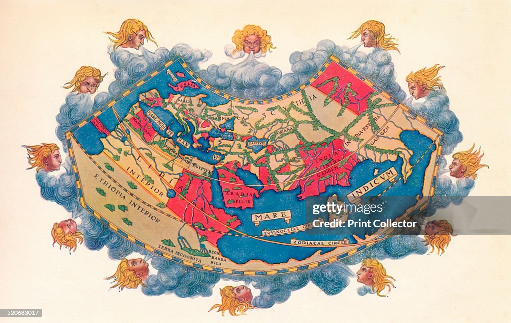
Ptolemy's Map of the World cA.D 150. (1912)
Ptolemy's Map of the World cA.D 150. The Ptolemy world map is a map of the known world to Hellenistic society in the 2nd century AD. It was based on the description contained in Ptolemy's book Geographia, written c150. Perhaps the most significant contributions of Ptolemy's maps are the first uses of longitudinal and latitudinal lines. Taken from 'A Book of Discovery', published by T. C. & E. C. Jack Ltd. 1912. (Photo by The Print Collector/Print Collector/Getty Images)

PURCHASE A LICENSE
How can I use this image?
€300.00
EUR
Getty ImagesPtolemy's Map of the World cA.D 150. (1912), News Photo Ptolemy's Map of the World cA.D 150. (1912) Get premium, high resolution news photos at Getty ImagesProduct #:520683017
 Ptolemy's Map of the World cA.D 150. (1912) Get premium, high resolution news photos at Getty ImagesProduct #:520683017
€475€115
Getty Images
In stockPlease note: images depicting historical events may contain themes, or have descriptions, that do not reflect current understanding. They are provided in a historical context. Learn more.
DETAILS
Restrictions:
Contact your local office for all commercial or promotional uses.
Credit:
Editorial #:
520683017
Collection:
Hulton Archive
Date created:
January 01, 1912
Upload date:
License type:
Release info:
Not released. More information
Source:
Hulton Archive
Barcode:
580028660
Object name:
2613142
Max file size:
4664 x 2944 px (7.77 x 4.91 in) - 600 dpi - 4 MB