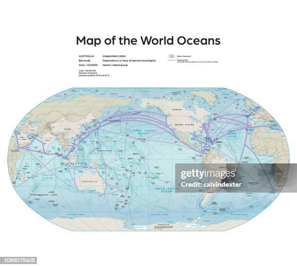
Map of the World Oceans - stock illustration
Vector illustration of the map of the world oceans.
Reference map was created by the US Central Intelligence Agency and is available as a public domain map at the University of Texas Libraries website.
https://www.cia.gov/library/publications/resources/the-world-factbook/attachments/docs/original/world_oceans.pdf?1528326243
Software used in the creation of the map is Adobe Illustrator CC

Get this image in a variety of framing options at Photos.com.
PURCHASE A LICENSE
All Royalty-Free licenses include global use rights, comprehensive protection, simple pricing with volume discounts available
€300.00
EUR
Getty ImagesMap Of The World Oceans High-Res Vector Graphic Download premium, authentic Map of the World Oceans stock illustrations from Getty Images. Explore similar high-resolution stock illustrations in our expansive visual catalogue.Product #:1088078608
 Download premium, authentic Map of the World Oceans stock illustrations from Getty Images. Explore similar high-resolution stock illustrations in our expansive visual catalogue.Product #:1088078608
€300€40
Getty Images
In stockDETAILS
Credit:
Creative #:
1088078608
License type:
Collection:
DigitalVision Vectors
Max file size:
2800 x 2510 px (9.33 x 8.37 in) - 300 dpi - 30 MB
Upload date:
Location:
Spain
Release info:
No release required
Categories:
- Map,
- Sea,
- World Map,
- Direction,
- Pacific Ocean,
- Shipping,
- Illustration,
- Arctic,
- Education,
- Global Communications,
- History,
- Infographic,
- Japan,
- Navigational Equipment,
- Africa,
- Antarctic Ocean,
- Arctic Ocean,
- Asia,
- Atlantic Ocean,
- Australia,
- Business,
- Business Finance and Industry,
- Color Image,
- Concepts,
- Cultures,
- Data,
- Design Element,
- Geographical Border,
- Horizontal,
- Ideas,
- Image-based Social Media,
- Indian Ocean,
- Industry,
- Information Medium,
- International Border,
- Journey,
- Land,
- Mediterranean Sea,
- News Event,
- North America,
- Outline,
- Politics and Government,
- Relief Map,
- Social Media,
- Spain,
- Technology,
- The Media,
- Topography,
- UK,
- Vector,